
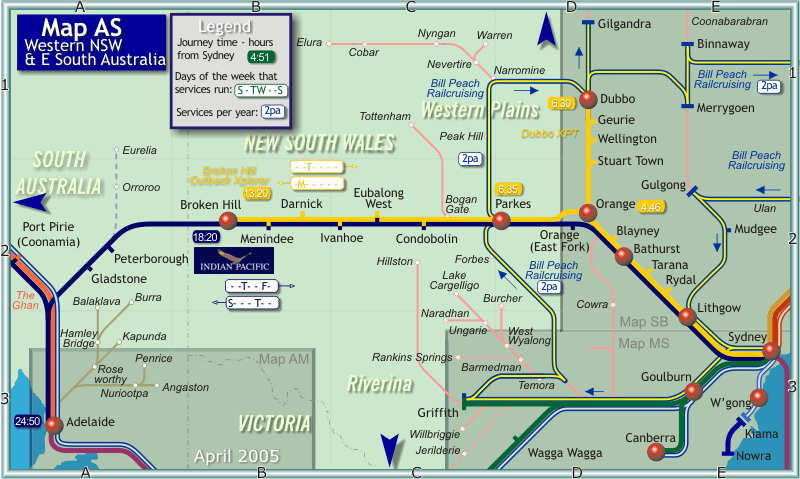
Map AS - Rail map of Western New South Wales and Eastern South Australia

|
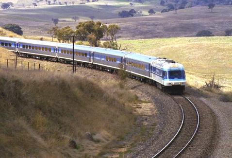
| Countrylink's Sydney to Dubbo XPT approaches Newbridge, west of Bathurst (Map reference D2). |
| Photo Courtesy Railpix |
Long distance trains in New South Wales are operated by the Government owned operator Countrylink. Their trains are operated almost exlusively by relatively modern trains capable of reasonably high speeds - although the nature of the tracks they traverse means that speeds are limited to something like that of road vehicles. The Countrylink XPT trains are based on the British HST, and the Xplorer trains are a slightly newer railcar train. XPTs and Xplorers are fully air-conditioned and offer buffet services. Some XPT services also provide sleeping berths in two-per compartment style. Countrylink operates a daily XPT train from Sydney to Orange and Dubbo. This train operates a return trip leaving Sydney in the morning and returning in the afternoon. Once per week, Countrylink operates an Xplorer tain from Sydney to Broken Hill, travelling our on Mondays and back to Sydney on Tuesdays.
Long distance trains to the West are operated by Great Southern Railways (GSR), a private company. Their major trains in this region are the weekly "The Ghan" ( Sydney-Adelaide-Alice Springs) and the twice weekly "Indian Pacific" (Sydney-Adelaide-Perth). GSR's trains are locomotive hauled and offer a full range of on-board services including sleeping berths and a buffet and dining car. These trains are not generally speedy, but they are comfortable and are promoted as 'land-cruises'.
A printer-friendly version of this map in pdf format can be downloaded by clicking here.
Other Railway Links
A complete station gazzetteer and historic maps of NSW Railways!