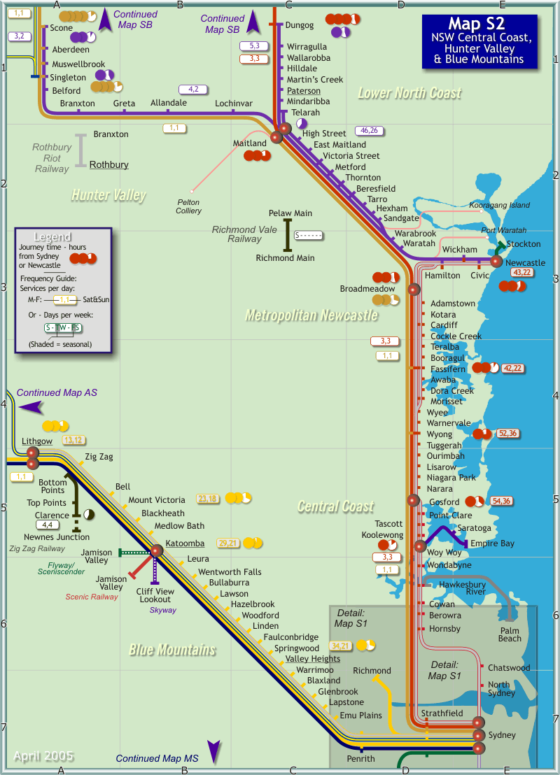
Map S2 - Hunter Valley, Newcastle, NSW Central Coast and Blue Mountains

|
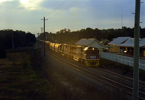
| A loaded coal train runs through Thornton station in the late afternoon sunlight. (Map Reference C2). |
| Photo Courtesy Railpix |
Most train services are operated by Cityrail, although a number of longer distance trains to points further North and West are operated by Countrylink. Cityrail operates an intensive electric double-deck inter-urban train services from Sydney Central station to Katoomba and Lithgow in the Blue Mountains, and to Gosford, Wyong and Newcastle in the North. These trains are comfortable and are air-conditioned but do not offer buffet services. Cityrail also operates less frequent diesel-train services from Newcastle station to Dungog, Muswellbrook and Scone. Generally there are a handful of services each day on these lines. Cityrail also operate moderately intensive suburban train services around the Newcastle suburbs comprising regular electric trains from Newcastle to Morrisett in the South, and from Newcastle to Maitland and Telarah in the North.
Countrylink operate long-distance XPT high-speed trains over the lines shown in this map, and in most cases it is possible to travel on these trains between Sydney and major stations. Countrylink trains are however much less frequent than Cityrail trains - operating only once per day (West and North-West) or three times daily (North Coast).
A printer-friendly version of this map in pdf format can be downloaded by clicking here.