Australian Rail Map
      Metropolitan rail maps
          Sydney rail map
          Hunter & Blue Mtns
          Illawarra & Sth Hlds
          Melbourne rail map
          Central Victoria
          Bendigo area
          Brisbane rail map
          Adelaide rail map
          Perth rail map
      Long Distance Trains
      Taking your car
      Fares & Bookings
      Index to Stations
      Holiday Itineraries
      Other Countries
      Legend & Help
      About this site
      Contact Us
      Buy rail maps
Rail Map of Brisbane

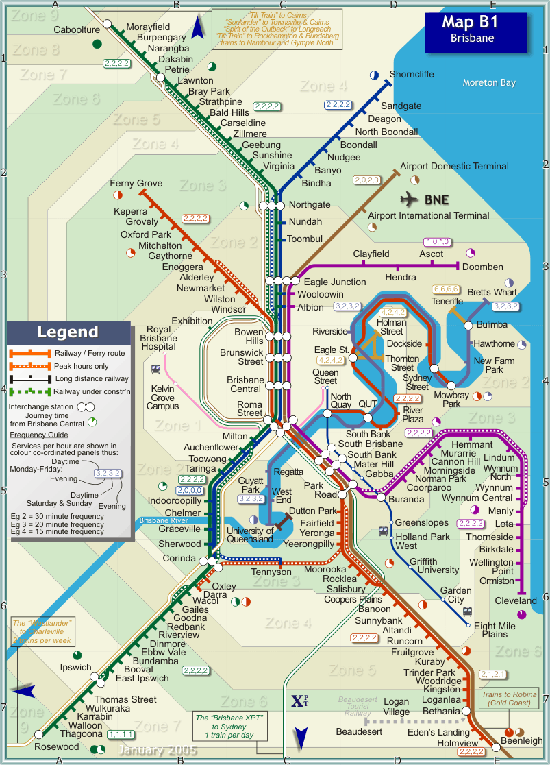
Map B1 - Brisbane Metropolitan area

A Citytrain approaches Northgate on its way from Brisbane to Shorncliffe. (Map Ref C2)
Photo Courtesy Railpix
This map covers the metropolitan Brisbane region of the state of Queensland in Eastern Australia. Brisbane, with a population of around 1.5 million, is Australia's third largest city. Its climate is generally warm, with wet humid summers and pleasant dry winters. The city is renowned for its relaxed outdoor lifestyle, but it is also a major centre for business and commerce. It is a fast developing city that prides itself on a 'can-do' attitude.

Electric train services are provided by Queensland Railways under the Brand name CityTrain. Services are fast and moderately frequent. All routes run to and from downtown Brisbane, with Roma Street and Central being the major downtown stations. For a more sedate experience, Brisbane has a number of delightful ferries that provide cross river, commuter and tourist services in the downtown area.

Queensland Railways (QR) official maps and track access details

A printer-friendly version of this map in pdf format can be downloaded by clicking here.